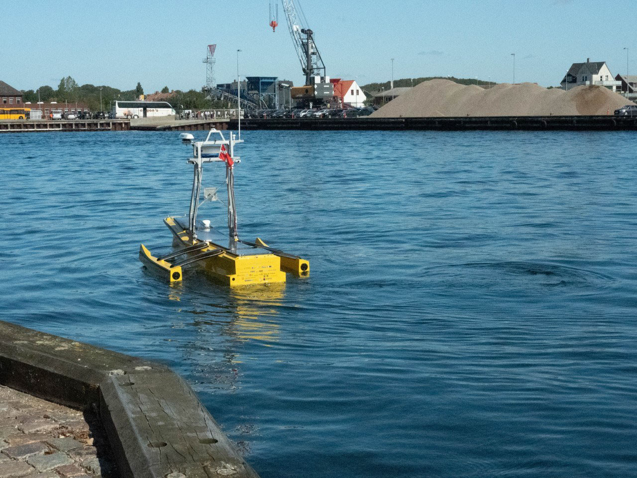
Customize Consent Preferences

We use cookies to help you navigate efficiently and perform certain functions. You will find detailed information about all cookies under each consent category below.

The cookies that are categorized as "Necessary" are stored on your browser as they are essential for enabling the basic functionalities of the site.... 

Always Active

Necessary cookies are required to enable the basic features of this site, such as providing secure log-in or adjusting your consent preferences. These cookies do not store any personally identifiable data.

Functional cookies help perform certain functionalities like sharing the content of the website on social media platforms, collecting feedback, and other third-party features.

Analytical cookies are used to understand how visitors interact with the website. These cookies help provide information on metrics such as the number of visitors, bounce rate, traffic source, etc.

Performance cookies are used to understand and analyze the key performance indexes of the website which helps in delivering a better user experience for the visitors.

Advertisement cookies are used to provide visitors with customized advertisements based on the pages you visited previously and to analyze the effectiveness of the ad campaigns.

AI-Powered Maritime Autonomy & Remote Control Solutions for Government & Commercial Vessels
Voyager AI Survey Autonomous capabilities for commercial survey vessels
Voyager AI Survey

Autonomous capabilities for commercial survey vessels

Visit Website Contact
Saved
Save
Voyager AI Survey

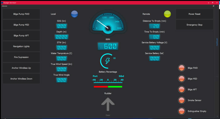
Voyager AI Survey is an entry-level software solution designed to provide commercial survey vessels with highly scalable smart autonomous navigation and payload control capabilities. Able to integrate with existing onboard sensors and data sources such as radar and AIS, it enables critical navigation, collision and obstacle avoidance and anti-grounding.

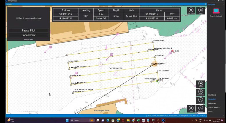
The software can import oceanographic and hydrographic survey plans from EIVA, Hypack or Qinsy, and provides a wide range of useful features including route and waypoint following, heading and track control, and radar and AIS overlays. It is ideal for a wide range of applications such as hydrographic and oceanographic surveys, offshore energy, and environmental monitoring.

Saved!

Visit My Account to view and manage your saved content.

Just click the icon at the top-right of the screen.