YellowScan

verified This business has been claimed by YellowScan and verified by OS&T.
Verified companies work with us to ensure we display the most up-to-date and comprehensive product information, articles and other material to help you choose the right solution for your requirements.
Innovative Bathymetric LiDAR Scanning Solution for Professional 3D Mapping & Surveying Applications France
Visit Website
Saved
Save
Contact
YellowScan

Innovative Bathymetric LiDAR Scanning Solution for Professional 3D Mapping & Surveying Applications

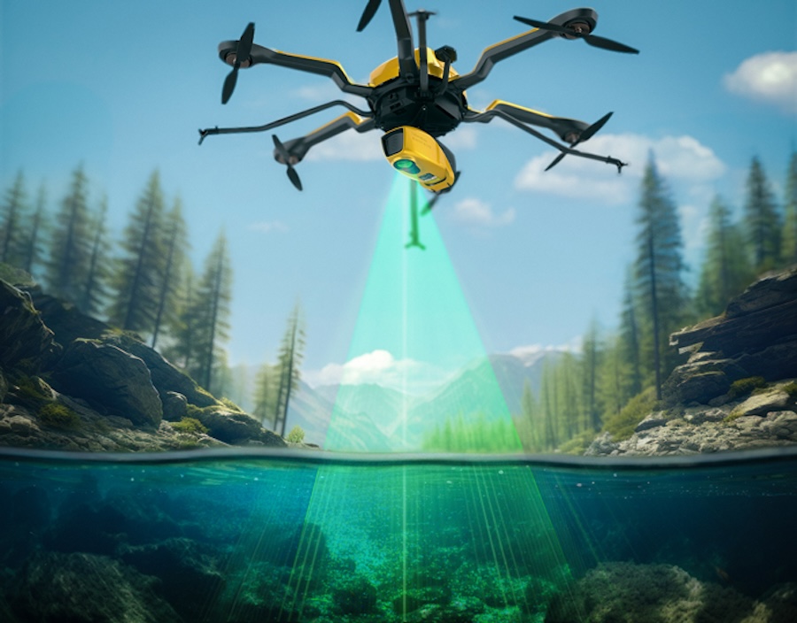
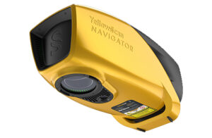
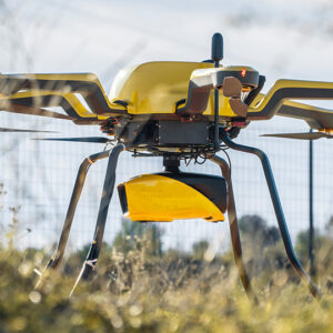
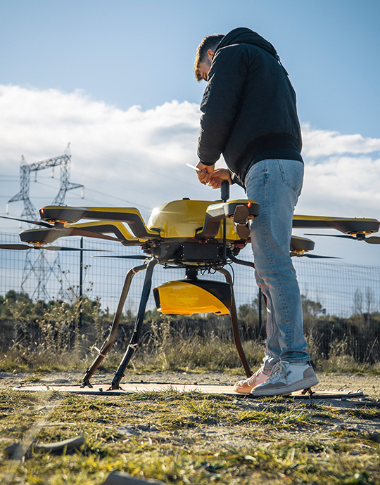
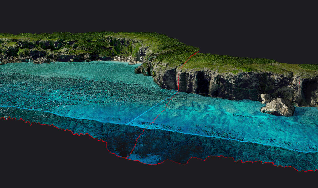
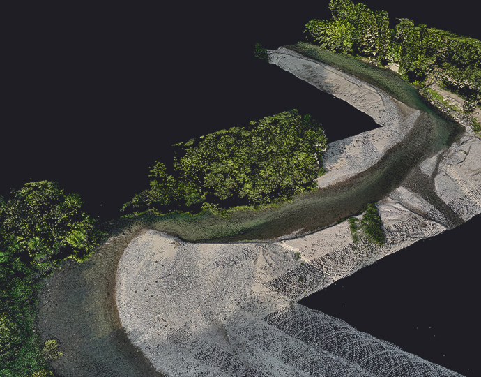
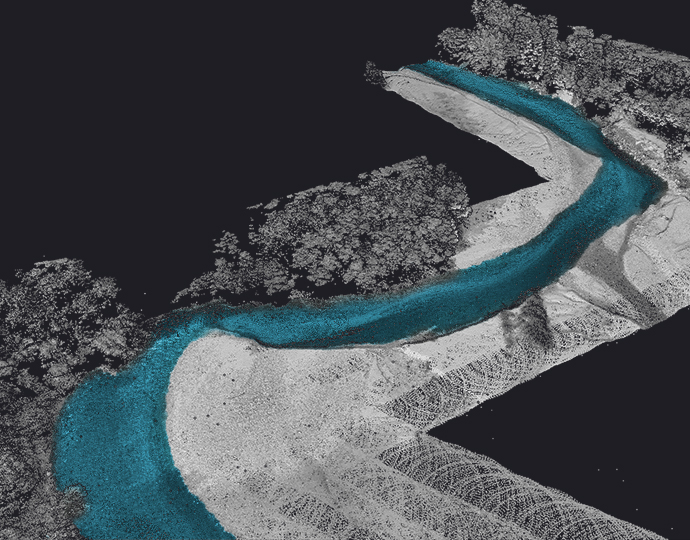
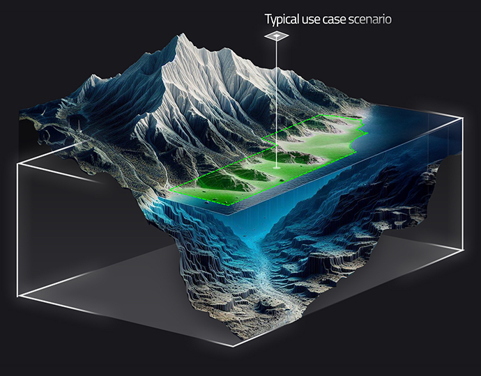
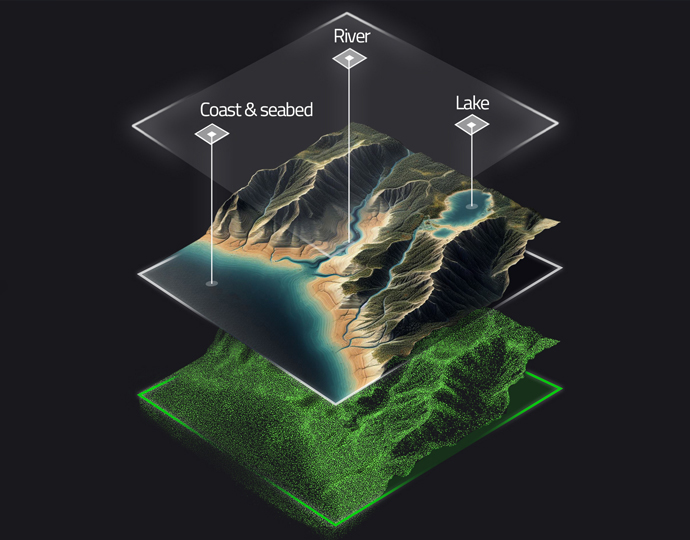
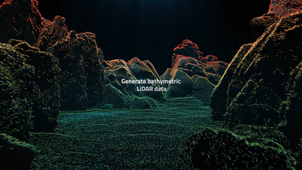
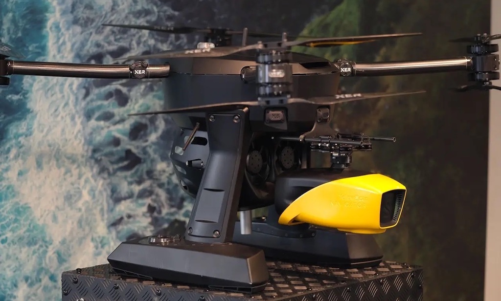
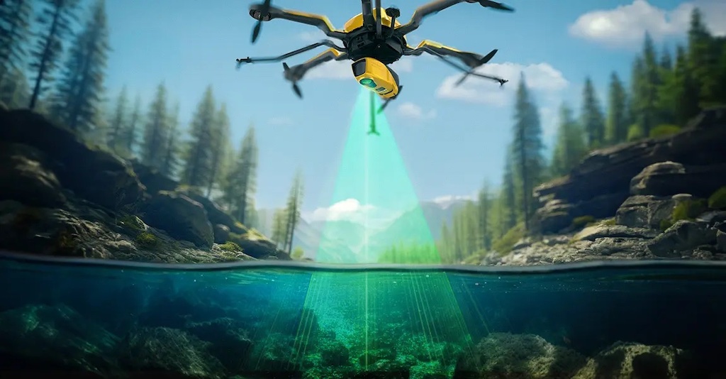
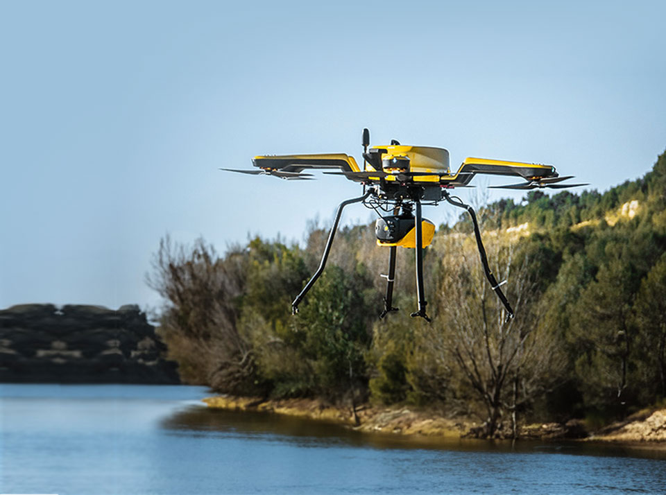
YellowScan is an industry-leading developer of innovative LiDAR scanning solutions for professional 3D mapping and surveying applications. We have developed a unique bathymetric LiDAR solution that provides continuous high-precision measurement of both water environments and the surrounding terrain, and can be installed on a variety of aerial platforms without compromising water penetration.

yellowscan bathymetric lidar

YellowScan Navigator

Innovative bathymetric LiDAR for simultaneous underwater and ground topography

YellowScan Navigatorbathymetric laser scanner is a lightweight and compact bathymetric LiDAR solution designed for surveying in shallow waters. Capable of penetrating down to 2 Secchi depths, it is ideal for characterizing a wide range of environments including shorelines, rivers, lakes, estuaries, ponds and gravel pits.

The system utilizes a proprietary green laser with a field of view selected for maximum underwater performance, coupled with an integrated global shutter RGB camera for full colorization.

Easy integration and maximum efficiency

Weighing less than 4kg, the rapidly-deployable YellowScan Navigator is suited for a wide range of multirotor and helicopter UAVs as well as manned aircraft, and features a quick-release attachment designed by leading payload developer Gremsy.

YellowScan Navigator offers up to 45 minutes of use on one charge, allowing you to maximize the efficiency of your bathymetric survey operations and gather more underwater data in a single flight.

YellowScan Navigator for bathymetric survey

Full calibration and support

All YellowScan Navigator units are fully calibrated before delivery, providing plug-and-play capability and allowing you to get airborne straight out of the box.

We can provide new customers with a complete two-day training course at your premises or online, including everything you need to know to get your marine surveys up and running. We also offer one year of unlimited expert technical support, ensuring that your projects can be completed trouble-free whether you are a new or highly experienced surveyor.

yellowscan lidar marine surveys

CloudStation software for optimized bathymetric mapping

Bathymetric survey productivity can be enhanced even further with our CloudStation processing software suite. The user-friendly software provides full generation and visualization of LiDAR pointclouds, and includes a number of advanced features designed for effective marine survey.

Underwater point correction – refines submerged data points, accounting for refraction and ensuring reliable mapping results with the utmost in accuracy

Underwater point correction

Automatic water classification – streamlines the categorization of different types of water bodies for enhanced efficiency

Automated water classification before

Before

Automated water classification after

After

Automated water surface detection – efficiently and accurately identifies the boundaries between water and the surrounding surface and subsurface terrain

The YellowScan Navigator package includes a license for the Essential version of our CloudStation software.

Discover sample data and data acquisition for the YellowScan Navigator bathymetric LiDAR solution

Applications

bathymetric lidar survey

bathymetric lidar for diverse water environment

River & Lake Analysis 
YellowScan Navigator is ideal for gathering the high-resolution data required for precise hydrological models of rivers and lakes, allowing surveyors to understand water flow and erosion behaviour. 

Coastal Oceanography
The bathymetric capabilities of YellowScan Navigator make it an essential tool for shoreline mapping, seafloor characterization, coastal vulnerability analysis, and other littoral applications. 

Underwater Structure Inspection
Bathymetric LiDAR can be used to characterize and analyze the condition of a variety of underwater structures, picking up defects and damage before they escalate into larger problems.

Marine Archaeology
YellowScan Navigator is an essential asset for marine archaeologists, providing efficient and effective modelling and surveying of shipwrecks, underwater ruins and other historical sites located in shallow waters. 

Marine Construction & Dredging
Bathymetric survey provides construction and marine works professionals with a wide range of crucial information, including water depth, habitat classification, seafloor mapping, and more.

Products

YellowScan Navigator

Bathymetric LiDAR scanner for simultaneous underwater and ground topography

Articles

Latest
YellowScan to Showcase Bathymetric LiDAR at Geo Connect Asia

YellowScan's advancements in bathymetric LiDAR technology will be at Geo Connect Asia 2025, April 9-10, where their CEO Tristan Allouis will also participate in a panel discussion

Apr 02, 2025
Profile Spotlight: Yellowscan & Bathymetric LiDAR Scanning

OST is helping Yellowscan to showcase its innovative LiDAR scanning solutions for professional 3D mapping and surveying applications in marine and maritime industries

Dec 13, 2024
Partnership for Long-Range Bathymetric Water Survey Technology

The integration of YellowScan’s Navigator bathymetric system into Xer Technologies’ drones offers a solution for long-range bathymetric surveys and underwater topography mapping

Aug 15, 2024
YellowScan Launches Bathymetric LiDAR Solution

This solution will precisely map both waterbed and land, which is mandatory for monitoring, modeling, and mitigating coastal erosion, flood hazards and understanding biodiversity habitats

Jan 15, 2024
Regional Offices & Locations
YellowScan France 525 Avenue Saint Sauveur du Pin
34980 Saint-Clément-de-Rivière
+33 4 11 93 14 00 Contact Website