Connect with Leading Marine Technology Innovators
Discover cutting-edge solutions from leading global suppliers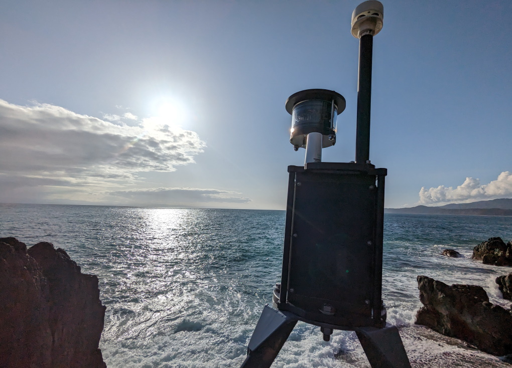
MarineLabs Data Systems has launched a new scalable end-to-end ocean camera data service, known as BuoyCam. The service provides subscribers with access to 360-degree, real-time views of ocean conditions through images from sensor locations along coastlines.
According to MarineLabs, this is the first scalable, end-to-end, buoy-mounted camera data product on the market. While some costly and large legacy buoys do have cameras, they experience down-time issues and are costly to maintain because they require specialized ships in order to deploy and maintain them.
Used in conjunction with other MarineLabs data, the images are accessed through MarineLabs’ CoastAware platform, on desktop or mobile devices. Through the platform, users click on the camera icon for a particular buoy where it will display 360-degree images from that location. This information is updated every 15-minutes in CoastAware. The BuoyCam module integrates with all MarineLabs hardware models that are rapidly deployable on existing navigational aids.
BuoyCam’s new weather awareness data feature improves the way search and rescue, harbour masters, and vessel pilots understand current weather conditions, visually. The feature enables a visual assessment of ocean conditions for mariners, helps them understand the current state of weather, and provides context to other data within CoastAware. The product helps users confidently and safely navigate using a visual reference to better understand surroundings like fog, debris in the water, and rough conditions.
The CoastAware BuoyCam service is currently in 16 beta testing locations along Canadian coastlines, in both the Atlantic and Pacific regions. The $1.1M trial with the Canadian Coast Guard is being funded through the Innovative Solutions Canada (ISC) Test Stream for a year. The Canadian Coast Guard will determine the additional value to Maritime Safety and management of their Aids to Navigation over that time period.
Dr. Scott Beatty, CEO of MarineLabs, commented: “Today, vessel pilots and mariners are navigating the coast using data points and maps that inform them on swell, tides, and weather conditions but they have no indicators for visibility on their routes. With MarineLabs’ BuoyCam service, pilots can now put visual context to what’s ahead, and determine whether conditions are safe for operations. This is a huge improvement for the industry.”
Captain Adam Parsons, Director of Operations and Harbour Master, Halifax Port Authority, noted: “Wind speed, wave height and sea conditions are all factors we consider not just daily, but several times each day when making operational decisions about vessel movements within the harbour. Advancements in technology, such as the addition of cameras on the hardware, led by groups like MarineLabs provide all of us working in the marine environment with information that will ultimately lead to safer outcomes for all involved.”