Connect with Leading Marine Technology Innovators
Discover cutting-edge solutions from leading global suppliers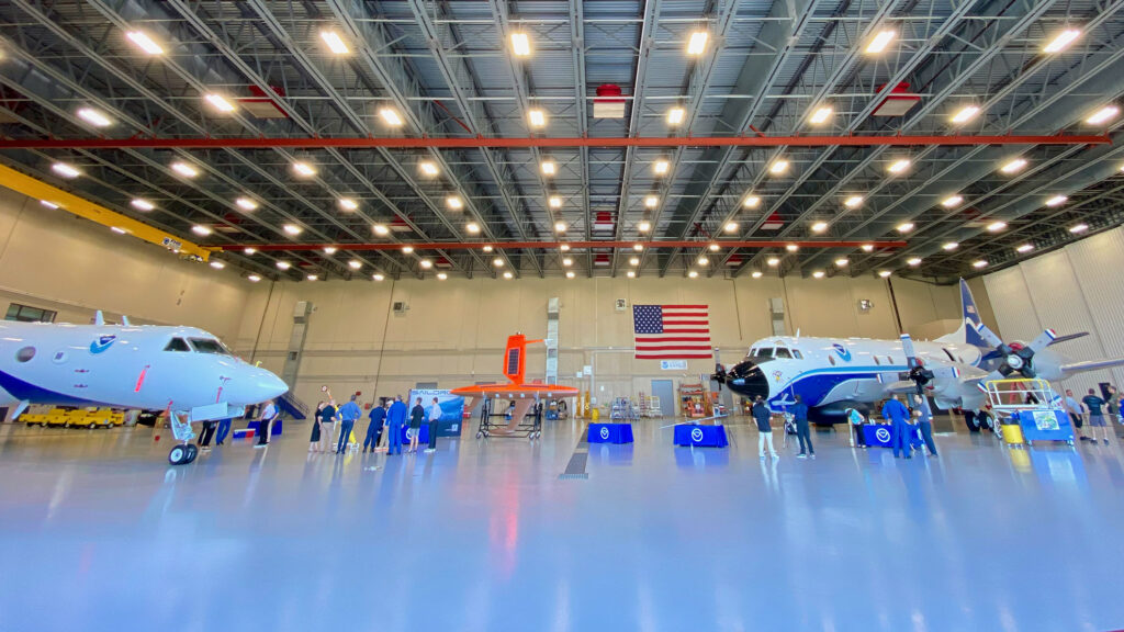
Saildrone has announced the deployment of a record 12 Saildrone Explorer vehicles into the Tropical Atlantic and Gulf of Mexico this summer.
The 12-vehicle fleet is the largest Saildrone has ever deployed for a single mission. The USVs (uncrewed surface vessels) will be supporting National Oceanic and Atmospheric Administration (NOAA) research into advanced hurricane forecasting.
A Saildrone Explorer is a 23-foot USV propelled by the wind and powered by solar energy, with a zero operational carbon footprint. Saildrone has designed a shorter, more robust wing to withstand hurricane wind speeds over 75 mph. During the past two missions in 2021 and 2022, Saildrone vehicles have sailed through several named storms and major hurricanes, including Hurricane Sam (2021) and Hurricane Fiona (2022).
Saildrone is deploying 10 vehicles from St. Thomas, US Virgin Islands, St. Petersburg, FL, and Charleston, SC, to transit to operate in areas with a high probability of intercepting a storm, as indicated by historical data. Two vehicles will remain on shore, ready for quick deployment in the event of an approaching hurricane.
“Saildrone is proud to support this critical research being conducted by our long-time partners at NOAA. It is an understatement to say that the ocean is a vast place, and we know relatively little about it. But the more vehicles we can deploy, the more data Saildrone can provide to address not only hurricane forecasting but other maritime challenges like illegal fishing, safety of life at sea, and safe navigation,” said Saildrone founder and CEO Richard Jenkins.
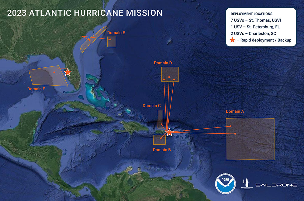
Atlantic Hurricane Mission
The third-annual Atlantic Hurricane Mission is part of ongoing research into how and why some relatively mild tropical storms rapidly intensify into major hurricanes, which is particularly destructive when it happens just before landfall. Of all recorded weather disasters in the US, hurricanes have had the most significant impact: Between 1980 and 2021, hurricanes were responsible for over $1.1 trillion total in damages and 6,697 deaths.
“Rapid intensification, when hurricane winds strengthen by 35 mph or more in a matter of hours, can be a serious threat to coastal communities. The data provided by Saildrone and the other uncrewed systems that NOAA is using will help us better understand the physical forces that drive hurricanes, with the goal of more accurate forecasts and earlier warnings for communities,” said Greg Foltz, a NOAA scientist and one of the mission’s principal investigators.
Improving hurricane forecast models
In addition to the Saildrone Explorers, NOAA is using a variety of aerial, surface, and sub-surface technologies, including its Hurricane Hunter airplanes, small, uncrewed aircraft systems (sUAS), gliders, drifters, and floats. The goal is to create a complete picture of the ocean-atmosphere interactions that drive hurricanes.
Metocean data will be transmitted in near real-time to scientists at NOAA’s Atlantic Oceanographic & Meteorological Laboratory (AOML) and Pacific Marine Environmental Laboratory (PMEL), Saildrone’s science partners in the mission.
Metocean data transmitted by the Saildrones includes:
- Air temperature and relative humidity
- Barometric pressure
- Wind speed and direction
- Water temperature and salinity
- Sea surface temperature
- Wave height and period
NOAA Research will use the data collected by the saildrones to improve hurricane forecast models. The data will also be archived by NOAA’s National Environmental Satellite, Data and Information Service (NESDIS) and sent by NOAA to the World Meteorological Organization (WMO)’s Global Telecommunication System (GTS), where it is available for the world’s major forecast centers—some 20 agencies worldwide, including NOAA.