Ocean Monitoring System Technology
Discover cutting-edge solutions from 7 leading global suppliers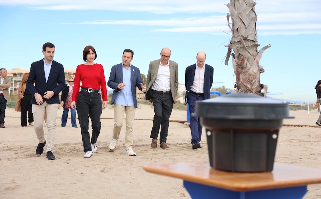
Smart buoys developed by the Spanish technology company Satlink, a leader in marine sustainability solutions, will be used for the first time in a project focused on beach regeneration.
This new and innovative buoy, named OceanDepth, will use a fit-for-purpose, integrated echosounder and algorithms to precisely measure the different layers of marine sediment accumulated on the seabed in coastal areas. The thickness of these layers can be used as a key indicator for beach regression, and for monitoring the short- and long-term dynamic processes in real time.
This pioneering project, launched by the coastal town of Canet de Berenguer and supported by the Spanish Ministry of Science, Innovation, and Universities, begins this week in the Valencian Community.
The Canet de Berenguer City Council aims to curb coastal erosion, a natural process caused by sediment displacement along the coastline and towards deeper parts of the sea, often — especially in the Mediterranean region — exacerbated by human activity in the coastal zone that impact coastal dynamics.
In this context, Satlink’s smart buoys are specifically designed to monitor the seabed (bathymetry) of beaches and coastal areas in real time. The collected data will be processed and transmitted to a data platform where computational software analyzes the evolution of beach profile and, on a potential second phase of the project, the effectiveness of installing artificial reefs towards its protection.
Cutting-Edge Technology for Coastal Monitoring
The OceanDepth buoy, a unique development in its field and backed by Satlink’s 30 years of experience in developing marine technology solutions, represents a significant step forward in coastal monitoring.
It provides real-time data on the seabed, water levels, and wave height. Thanks to its satellite connectivity, it ensures instant and accurate data transmissions, enabling continuous monitoring of beaches and coastal areas.
Powered by solar energy, which eliminates the need for manual intervention after deployment and measuring campaigns to continue as long as desirable, OceanDepth is supported by an intuitive management software that allows for seamless interaction with the data collected by all deployed buoys. This software does not only displays real-time measurements and locations, but also offers a detailed historical record of bathymetry and its changes over time.
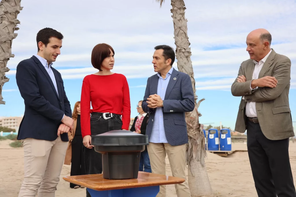
The project was kicked-off on December 7 by the town’s mayor, Pere Antoni Chorda, with the attendance of Diana Morant, Spanish Minister of Science, Innovation, and Universities. The project’s potential results have generated significant anticipation within the scientific and coastal communities, and embody the possibilities for coastal management by using new technologies.
During the presentation, Morant emphasized that this is an “exciting and necessary” initiative to address the impact of climate change on coastlines, stating that “we need knowledge and an understanding of what’s happening on the seabed to make the best decisions.”
Chorda added that “the solution to beach regression lies in innovation, where technology allows us to model the seabed and understand sediment movement to make informed decisions about installing a submerged reef to reduce wave energy and prevent further coastal erosion.”