Unmanned Surface Vehicles
Discover cutting-edge solutions from 8 leading global suppliers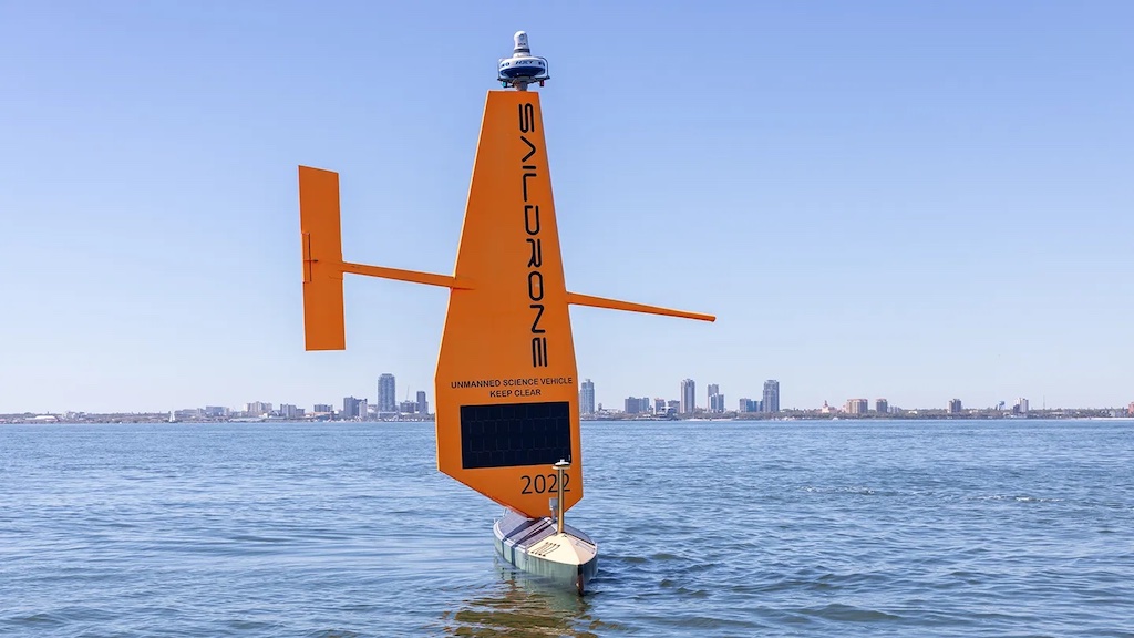
The Florida coast is known for many things: tourism, wildlife, fishing, shipping, and hurricanes. At 2,170 kilometers long, Florida’s coastline is second only to Alaska among US states. However, many parts of the coast remain unsurveyed, and existing nautical charts rely on outdated and low-resolution data.
The Florida Seafloor Mapping Initiative (FSMI) aims to fix that by collecting a comprehensive high-resolution seafloor data set of Florida’s coastal waters within the continental shelf by 2027.
The Florida Department of Environmental Protection (FDEP) is managing the project, using $100 million in state funds to collect the data and create a public portal for the new imagery and information.
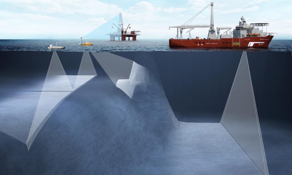
Saildrone is contributing to this effort by deploying two 10-meter Saildrone Voyager unmanned surface vehicles (USVs) from its facility in St. Petersburg, FL. Saildrone will map the Middle Grounds, a 2,817-square-kilometer area of the seafloor in the Gulf of America approximately 130 kilometers northwest of St. Petersburg.
Saildrone has been tasked to map some of the project’s deeper waters. Equipped with NORBIT WINGHEAD i80s multibeam sonar—as well as radar, AIS, and cameras for maritime domain awareness—the Voyager USVs will capture high-resolution bathymetry at depths of 20 to 100 meters.
Primarily powered by wind for propulsion and solar energy for onboard sensors, Saildrone Voyager USVs can stay on mission for months at a time, crisscrossing the area of operation to collect vital high-resolution seafloor data.
Last year, Saildrone conducted a similar mission in the Gulf of Maine, mapping 5,100 square kilometers in the north-central Gulf of Maine in support of the National Oceanic and Atmospheric Administration (NOAA)’s survey of deep-sea coral habitats. The Gulf of Maine has a complex topography of deep basins, shallow banks, and steep slopes, and the deeper waters, in particular, had limited data available. Two Voyager USVs mapped the area, at depths up to 300 meters.
In 2022 and 2023, one of Saildrone’s larger Surveyor USVs spent months mapping the US Exclusive Economic Zone off the coasts of California and Alaska. During that mission, the Surveyor mapped 45,000 square kilometers of previously unknown ocean floor and discovered a previously unknown seamount off California. This effort was managed by NOAA and the Bureau of Ocean Energy Management at the Department of the Interior.
In 2024, Saildrone began a mission to map the Cayman Islands EEZ—a significant 100,496 square kilometers of sea space in the Caribbean Sea. That mission is expected to be completed later this year.
Governments often invest in mapping their EEZs to better understand the natural resources within their territorial water and the topography under these waters. In 2020, the United States released the National Strategy for Ocean Mapping, Exploring and Characterizing (NOMEC) the United States Exclusive Economic Zones, including coastal, ocean, and Great Lakes waters. This effort would map deep waters by 2030 and shallow waters by 2040.
Florida’s ongoing mapping effort will contribute to this larger strategy and demonstrate how state customers could leverage Saildrone’s unmanned ocean mapping capabilities.
Ultimately, the data collected by Saildrone and others will help update coastal maps and navigational charts that identify navigation hazards, provide information for use by emergency responders, demonstrate Florida’s coastal vulnerability to hurricanes, aid in flood risk mapping and coastal resilience efforts, protect offshore infrastructure, map animal habitats, and provide data for scientific research.
Brian Connon, Saildrone VP Ocean Mapping, commented, “Saildrone USVs efficiently and safely collect high-resolution bathymetric data while minimizing environmental impact. Saildrone is proud to support the Florida Seafloor Mapping Initiative with our unique and innovative Voyager USVs.
“As a member of the St. Petersburg community, we are excited to contribute to a project that seeks to improve our coastal resilience and enhance our ability to predict storm surge impacts by providing high-resolution bathymetry.”