Geospatial Technology for Marine and Maritime Applications
Geospatial technology plays a critical role in marine science, navigation, and environmental monitoring, providing powerful tools for mapping and analyzing oceanic and coastal environments. From advanced GIS software to high-resolution bathymetric surveys, these technologies enable precise spatial analysis of the ocean floor, aiding in research, exploration, and marine resource management. As advancements in photogrammetry, artificial intelligence, and 3D mapping continue to evolve, geospatial tools are transforming our understanding of marine and maritime environments.
Overview
Geospatial Technology for Marine and Maritime Applications
By
Staff Writer Last updated: March 18th, 2025
Geospatial technology encompasses a range of tools and methodologies used to collect, analyze, and visualize spatial data. In marine science, these technologies are crucial for understanding ocean topography, tracking changes in coastal ecosystems, and supporting maritime operations. Geographic information systems (GIS) provide an essential framework for mapping and analyzing oceanographic data, helping researchers and industry professionals make informed decisions about marine environments.
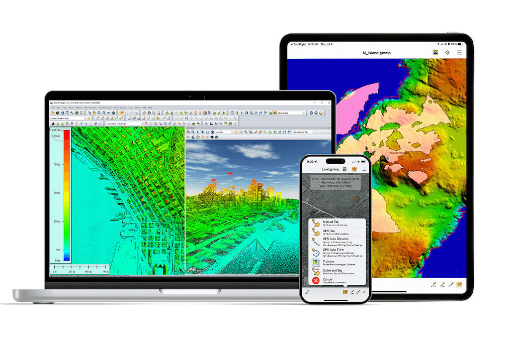
One of the key applications of geospatial technology in the maritime sector is bathymetric surveying, which involves mapping the underwater terrain to produce detailed representations of the ocean floor. By utilizing sonar, lidar, and photogrammetry software, scientists can generate high-resolution bathymetric maps that support navigation, habitat assessment, and resource exploration. These bathymetric survey data sets provide vital insights into seafloor structures, underwater hazards, and sediment transport patterns.
Another essential aspect of marine geospatial technology is georeferencing, which aligns spatial data with real-world coordinates. Accurate georeferencing ensures that maps, nautical charts, and 3D GIS models reflect true oceanic positions, allowing for precise tracking of maritime routes, underwater structures, and environmental changes.
GIS Mapping and Ocean Data Analysis
GIS mapping software is at the core of geospatial technology, offering advanced tools for managing and visualizing oceanic data. With GIS tools, marine researchers and navigators can overlay multiple layers of information—such as depth contours, seabed composition, and ocean currents—onto a single map. These maps support diverse applications, including:
Marine navigation: Nautical maps and electronic charting systems use GIS data to provide accurate routing information for ships and autonomous vessels.
Environmental monitoring: GIS mapping aids in tracking pollution, coral reef health, and sea level changes, helping to guide conservation efforts.
Offshore resource management: Oil, gas, and renewable energy industries use GIS-based ocean maps to plan and optimize underwater infrastructure development.
Incorporating point cloud data into GIS models enhances the accuracy of ocean mapping. Point clouds, generated through lidar scanning or photogrammetry, create dense 3D representations of underwater landscapes. Point cloud classification techniques further refine these datasets, distinguishing between seabed features, marine vegetation, and submerged structures.
AI-powered image analysis and object detection are also transforming GIS mapping in marine research. AI image recognition can automatically identify features in satellite imagery, such as shifting sandbanks or algal blooms, providing valuable insights for marine resource management. Land cover classification using drone data is another growing application, allowing for detailed coastal and intertidal zone assessments.
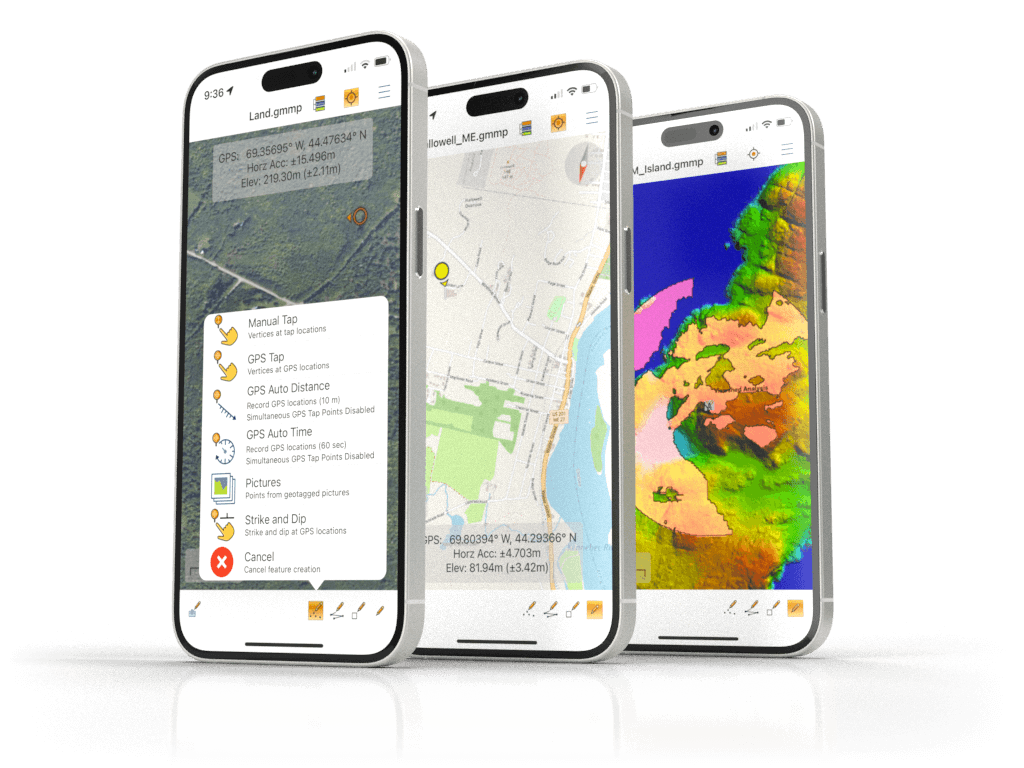
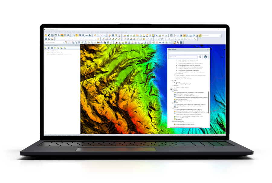
Geospatial Technology and GIS Software - Global Mapper by BlueMarble Geographics
Bathymetric Mapping and 3D Geospatial Visualization
Bathymetric mapping is fundamental to understanding ocean depth variations and seafloor topography. Traditional methods, such as single-beam and multibeam sonar, are now complemented by 3D mapping software that creates highly detailed ocean depth maps. These technologies enable scientists to study underwater geological formations, detect shipwrecks, and monitor sediment displacement over time.
Kriging and variography
Kriging and variography are statistical methods used in geospatial analysis to predict unknown values based on spatially correlated data points. These techniques improve the accuracy of bathymetric survey data, reducing uncertainty in underwater mapping and ensuring that digital ocean models closely reflect real-world seafloor conditions.
For advanced marine applications, marine GIS integrates bathymetric data with ocean current models, sediment transport simulations, and environmental impact assessments. This level of geospatial analysis is essential for marine construction projects, fisheries management, and climate change research.
Applications of Geospatial Technology in Ocean Exploration
The integration of geospatial technology with autonomous marine systems, satellite remote sensing, and deep-sea exploration is driving new discoveries in oceanography. Drone camera data collected from aerial surveys is increasingly used to complement traditional ship-based measurements, providing high-resolution imagery of coastal and offshore environments.
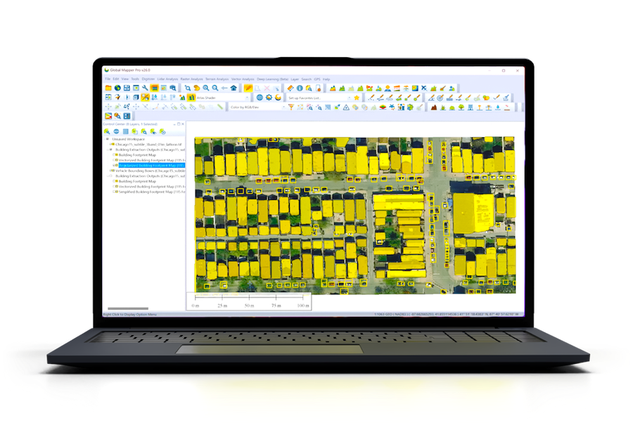
GIS Mapping App for Global Mapper by BlueMarble Geographics
In the field of ocean floor mapping, geospatial tools assist in uncovering previously unknown underwater features, including ridges, trenches, and hydrothermal vents. These discoveries enhance our understanding of plate tectonics, ocean circulation, and deep-sea ecosystems.
For marine navigation, nautical maps and nautical charts that incorporate real-time GIS updates improve situational awareness for vessels operating in complex maritime environments. GIS consulting companies offer specialized solutions for integrating oceanographic data into vessel tracking systems, ensuring safe and efficient maritime operations.
Geospatial Technology in Marine Science
Geospatial technology continues to revolutionize ocean mapping, marine navigation, and environmental research. From GIS software to bathymetric surveys, these tools provide invaluable insights into underwater landscapes and support a wide range of maritime applications. The combination of 3D GIS software, point cloud classification, and AI-driven image analysis is enhancing the precision of oceanographic studies and facilitating smarter marine decision-making.
As advances in geospatial technology progress, its role in marine science, resource management, and ocean exploration will only expand, shaping the future of maritime industries and environmental conservation efforts.
Blue Marble Geographics has been working with OST to showcase its innovative geospatial software and mapping solutions for marine, coastal, and offshore applications
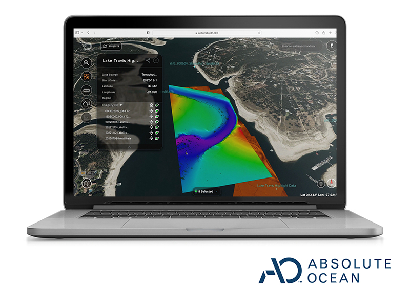
Terradepth has officially launched Absolute Ocean, centralizing seabed mapping, asset tracking, and environmental data in one cloud-native geospatial platform
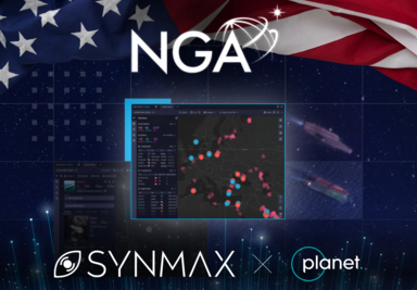
SynMax has secured a pilot project award from the NGA for its advanced maritime domain awareness tool, Theia, enabled by comprehensive satellite data from Planet Labs
In Singapore on March 6-7, SatLab showcased a variety of marine surveying technology, including its HydroBoat 1200 USV, HydroFlow Acoustic Doppler Current Profiler, and more
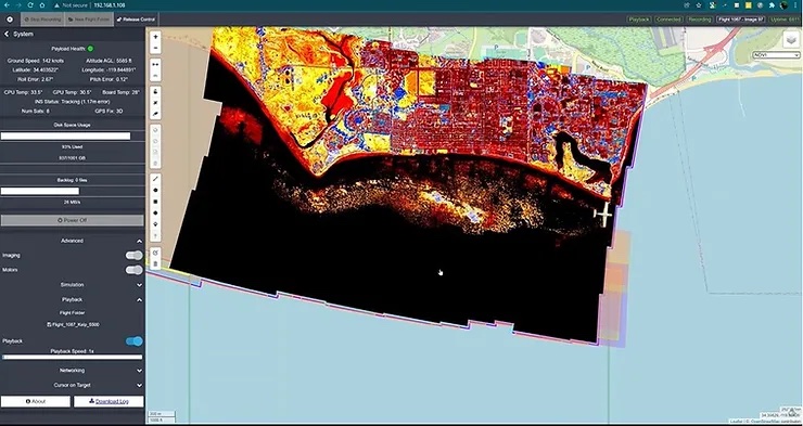
Overwatch Imaging’s smart sensors capture imagery across multiple spectral bands at once in a co-boresighted array with a dual-antenna GPS INS, enable kelp forest mapping from the air